Qualitative Sheen Assessment Results
Sheen Assessment
Early in the response, under the oversight of EPA and its partners, Norfolk Southern began monitoring surface water quality downstream of the site and took measures to restore water quality, including sediment washing and air sparging in Sulphur and Leslie Runs. Air sparging involves spraying water to add air so that oxygen and microbes can break down chemicals. Air sparging is a standard technique used in emergency responses like this derailment to eliminate chemicals from water.
As a result of this treatment, surface water results have been below levels considered to be hazardous to human health. While surface water is no longer adversely impacted, when creek beds (sediment) are heavily disturbed, sometimes shiny iridescent patches, called sheen, will float on the water’s surface.
On October 18, EPA issued an order under the Clean Water Act requiring Norfolk Southern to conduct additional sediment cleanup and sheen investigations, focused on oily sheens and sediments in Sulphur and Leslie Runs. The qualitative assessment of the stream is complete, and the results are posted below. Preliminary results indicate that oil-related compounds are predominant where sheen is present, and sheen is present when sediments are disturbed in more than half of the waterways.
Crews collected samples of sheens and associated sediments to determine their chemical makeup. Preliminary results of that sampling are undergoing review. That review will guide planning for precisely how and where additional cleanup and monitoring of the streams will be conducted.
EPA continues to advise avoiding Sulphur and Leslie Runs while assessment and cleanup work is ongoing, and to adhere to posted warning signage along the creeks.
Observation Data
Crews walked both Leslie and Sulphur Runs to disturb the creek bed every 25 feet to look for visible sheen. They assessed the creek at 739 locations downstream of the derailment. These locations are highlighted in orange in the dashboard map below.
Crews also assessed at 89 background locations, which are upstream from the derailment site. Background locations are areas that were not impacted by the derailment. Assessing background allows investigators to compare the streams where oil was discharged with where it wasn’t. Background locations are highlighted in green in the dashboard map below.
If crews observed sheen, they assigned a score on a 0-to-3 scale depending on the amount of sheen visible. Zero means no sheen was present and three means lots of sheen was present. In Leslie Run, 59% of locations had some sheen, compared to 66% of locations in Sulphur Run. In background locations, 92% of areas had no sheen. In the dashboard below, you can select different stream segments to see the breakdown of the sheen results observed in each segment, as well as photos from different points along the segment.
Interpreting Results
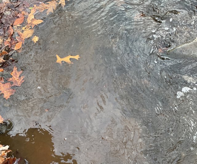
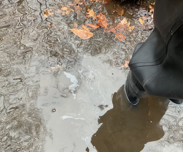
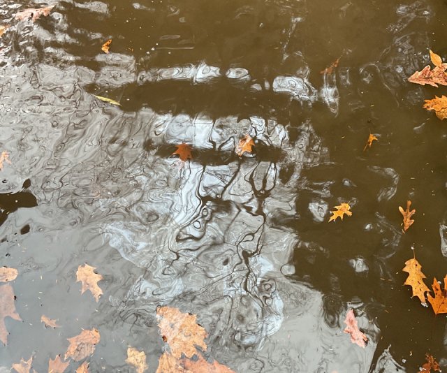
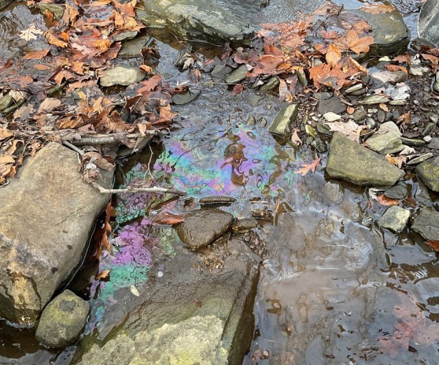
Crews evaluated sheen based on its speed of release from the disturbed sediment, its horizontal expanse, and the presence of odor, to assign the sheen a score. Here are examples of water with different sheen scores.
No sheen

Light sheen

Medium sheen

Heavy sheen

