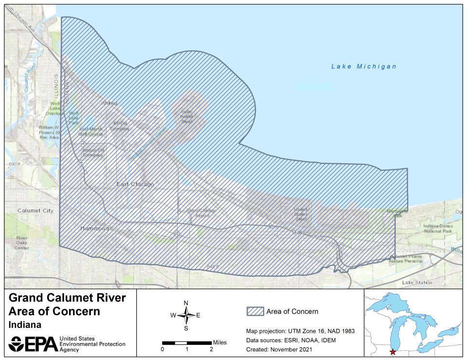
The Grand Calumet River AOC Boundary Map

The Grand Calumet River originates on the east side of Gary, Ind., and is comprised of two east-west flowing branches that cover the southern end of the Indiana Harbor Ship Canal. The eastern branch of the river drains into Lake Michigan. The AOC area, which is 22 square miles in total, encompasses portions of the cities of Gary, East Chicago, Hammond, and Whiting, Ind., and is defined by:
- The Indiana/Illinois state line to the west
- Grand Avenue around Marquette Park lagoons in Gary to the east
- The southern boundary extending to the Tolleston Beach Ridge
- The northern boundary on Lake Michigan which includes a 1.5-mile buffer out into the lake
The following files are available for download for the Grand Calumet River AOC:
