New MicroTrac Tool Enhances Air Pollution Exposure Assessments
Published March 26, 2018

Questionnaires and diaries depend on study participants recording accurate information. Individuals may have trouble remembering, make errors in reporting, and omit data. Meanwhile, stationary outdoor monitors do not account for the time individuals spend in various locations that could have different air pollutant concentrations. One city street with high traffic or near heavy industry, for example, may have higher air pollution levels than another street a few miles away. MicroTrac can be used to enhance exposure assessments by correctly identifying where people are when they are exposed to air pollution.
“MicroTrac offers a more accurate way of seeing how much time people spend in different locations,” says Michael Breen, a lead EPA scientist on the MicroTrac project. “This is an important contribution to air pollution exposure assessment research because exposure to air pollution levels can change in different locations.”
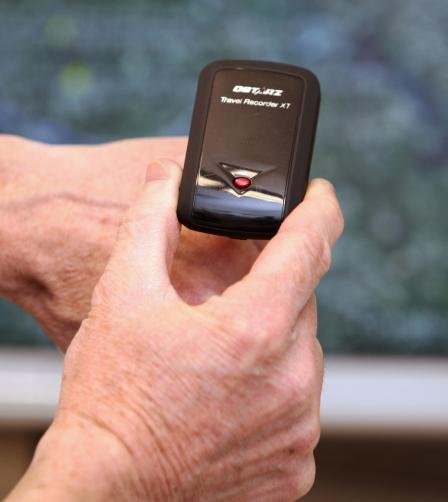
To run MicroTrac, users need to download the MicroTrac model from EPA’s website and then input Global Positioning System (GPS) data from their phone or other electronic devices into the model. The model then classifies this information into eight microenvironments (indoors and outdoors at home, work, school; inside vehicles; and other locations). The use of GPS technology and location information makes MicroTrac more accurate at tracking time spent in different locations than other methods used for exposure and health research.
In a pilot study in central North Carolina, researchers evaluated the ability of MicroTrac to estimate the time of day and the time spent at different locations. Adult participants living in suburban areas used both the MicroTrac model and diaries to track activity and time spent at eight different microenvironments. The published findings showed that MicroTrac classified the location of participants correctly 99.5 percent of the time. Researchers are conducting additional evaluations at North Carolina State University in Raleigh, NC, and Hong Kong University of Science and Technology.
There are multiple uses of the new exposure assessment tool. MicroTrac can empower communities to learn more about local air quality in studies by using the tool with exposure models or personal air pollution sensors. Researchers can link their activity and location of study participants to pollutant concentrations and health effects. Public health officials also can use MicroTrac and exposure models to alert asthmatics and other susceptible populations to specific locations with compromised air quality that could affect health. States and communities can use MicroTrac along with personal air pollution sensors to determine a person’s exposure to air pollution in different microenvironments, which could help prioritize efforts to reduce air pollution concentrations in specific locations.
EPA researchers developed the MicroTrac model to help fill in the gaps of air pollution exposure assessment and are refining the tool and its configurations for broader utility. Because air pollution levels can change depending on location and time of day, using this model allows researchers and communities to have a more complete picture of individual exposures to air pollution. MicroTrac is an important resource that can help advance health studies and support public health strategies to reduce air pollution exposure.
This article appears in the February 2018 issue of EM Magazine, a copyrighted publication of the Air & Waste Management Association (A&WMA; www.awma.org).
