Science and Social Justice in the San Juan Bay Estuary

When it rains, it floods along the Caño Martín Peña in San Juan, Puerto Rico. This 3.75-mile-long tidal channel that should flow freely through the San Juan Bay Estuary has developed a clog that’s impacting the health of the estuary and its citizens.
Now, EPA researchers are trying to understand how San Juan Bay Estuary and its residents are impacted by the closure of the Caño Martín Peña and are working with local partners to ensure the health, safety and well-being of communities in the region.
A Clog in the Caño
The Caño Martín Peña’s closure began to form in the mid-20th century, when mangrove forests flanking the channel were cleared and infilled, largely with garbage and debris, until the land was firm enough to build homes upon. Over time, this fill material – along with other natural sediment and debris – clogged the channel, causing a near-total blockage in the last 20 years.
Today, the largely working class and low-income communities near the Caño Martín Peña experience frequent flooding that results in water-filled streets, homes and schools. Storm drains can’t keep up with the deluge of water and urban runoff, and dangerously high levels of fecal coliform can be found in flood water due to an inadequate or nonexistent sewer infrastructure. These communities also report higher incidences of asthma and gastrointestinal illness than the general population.
An Estuary of National Significance
The Caño is part of the San Juan Bay National Estuary Program (NEP), an EPA place-based program to protect and restore the water quality and ecological integrity of estuaries of national significance. Currently, 28 estuaries located along the Atlantic, Gulf, and Pacific coasts and in Puerto Rico are designated as estuaries of national significance. Each NEP focuses within a study area that includes the estuary and surrounding watershed. Each NEP has a Management Conference (MC) that consists of diverse stakeholders and uses a collaborative, consensus-building approach to implement the Comprehensive Conservation and Management Plan (CCMP). Moreover, each MC ensures that the CCMP is uniquely tailored to the local environmental conditions and is based on local input, thereby supporting local priorities. Dredging the Caño and improving environmental conditions in the area is one of the top priorities of the San Juan Bay National Estuary Program’s CCMP.
Studying Impacts of the Blocked Channel
Beginning in 2015, EPA scientists embarked on a two-fold research effort to track flooding patterns across Caño Martín Peña communities and understand how the channel’s closure is impacting San Juan Bay Estuary as a whole.
“For the people who live in these communities, flooding is the number one environmental problem – but there’s no scientific documentation of the frequency, duration, and extent of flooding,” said EPA researcher and project lead, Autumn Oczkowski. “What areas flood? When? How much? Documenting the flooding is one aspect of our research that our community stakeholders are very interested in.”
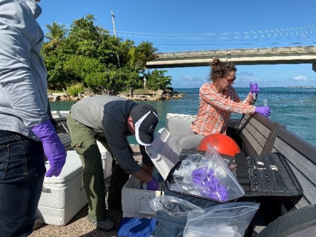
To document flood patterns, EPA scientists deployed a combination of water level loggers and inexpensive water-detecting sensors at targeted locations, like the entrance to an elementary school whose entrance is often blocked by flooding. Researchers also studied how key nutrients – like nitrogen, phosphorous, carbon and sulfur – move through the estuary, and measured for contaminants of emerging and immediate concern (CECs).
“We were trying to gather some baseline information on what nutrients and CECs are present and at what concentrations,” Oczkowski explained. “This information can help identify regions of the estuary that may need special attention for environmental restoration.”

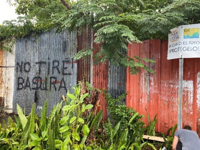
Autumn Oczkowski deploys a light and temperature monitor to collect flooding data in the Caño Martín Peña near a request from community members to not dump trash in the area.
Working with Community Partners

To make their research most impactful for estuary communities, EPA scientists worked from day one to develop relationships with local researchers and stakeholder groups that have first-hand knowledge and connections with Caño Martín Peña citizens and leaders.
During their first trip to San Juan, EPA researchers met with a local public organization, Corporación del Proyecto ENLACE del Caño Martín Peña (ENLACE). ENLACE was created by the government of Puerto Rico, and their main mission has been to oversee and implement a plan for the Caño Martín Peña district, while maintaining community structure and pursuing environmental rehabilitation and flood mitigation for the region. They also help relocate those most vulnerable to the flood waters to safe homes on higher ground.
Oczkowski was particularly inspired by how effectively ENLACE did their work while engaging the community. “The community has been an invaluable asset to this project,” she acknowledged. “It’s not overstating things to say that without the help and support of ENLACE and Caño Martín Peña residents, very little research would have been done.”
Moving forward, EPA researchers continue to share data and other information with San Juan Bay communities to help inform decision-making related to Caño Martín Peña.
Data gathered about flood patterns helps ENLACE advocate, raise awareness and justify funding to begin the construction phase of dredging the Caño and implement necessary sanitary and stormwater infrastructure projects. EPA findings are also provided to community leaders and residents through meetings, workshops, handouts and other activities to inform, educate and raise awareness about the impacts of environmental degradation in their communities.
Oczkowski and her team hope that the results of this work will help improve human health and the quality of life, as well as the health of the whole San Juan Bay Estuary. “There is an important environmental justice aspect to identifying the stressors on tropical urban estuaries,” Oczkowski said. “
“We are just beginning to scratch the surface of what may be a completely understudied field of research.”
