Climate Adaptation Profile: Wyckoff Co./Eagle Harbor
Bainbridge Island, Washington
Site Description

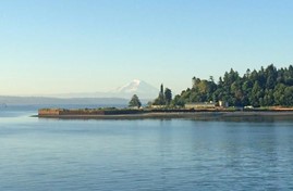
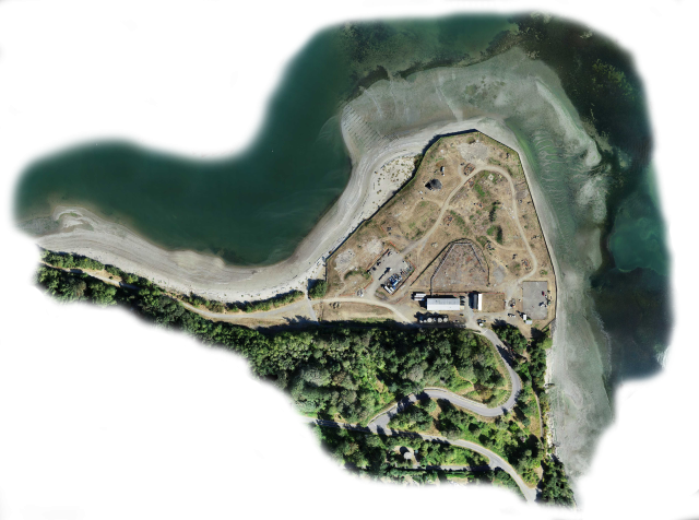
Extensive investigation and cleanup activities have taken place since the late 1980s at the Wyckoff/Eagle Harbor site in Kitsap County, Washington, along Puget Sound. Due to its past use as a wood-treating facility, the site is contaminated by creosote, other wood-preserving chemicals and nonaqueous-phase liquid (NAPL). The site includes the former wood-treating area located on the harbor’s south shore, contaminated subtidal and intertidal sediments along the south shore, and contaminated upland areas. The Suquamish Tribe maintains treaty rights to gather resources within Eagle Harbor.
Remediation Activities
Approximately 100 acres of intertidal and subtidal sediments in Eagle Harbor were covered with an engineered cap. Additional dredging will be conducted, and sediment on beaches north and east of the former wood-treating area will be covered with a multilayer cap.

The U.S. Environmental Protection Agency (EPA) has completed multiple remedial actions in upland areas of the site, including removal of contaminated soil and sludge, building demolition, and installation of a perimeter sheet pile wall that reduces seepage of contaminated groundwater. A groundwater pump and treat (P&T) system, which currently involves nine recovery wells screened in the upper aquifer, has operated for more than 30 years to draw contaminated groundwater and NAPL away from the site perimeter. The P&T system also maintains an upward vertical gradient that minimizes transport of contaminants from the upper aquifer to the lower aquifer.
Vulnerability to Climate Change Impacts
The site is vulnerable to sea level rise, which is projected to increase by one foot by 2060. Tidal swings at the site currently range from a mean lower low water (MLLW) level of -4.5 feet to +14 feet. The site is also vulnerable to erosion in intertidal areas, which could impact the engineered sediment cap.
Due to proximity to the Seattle Fault line, the site is additionally vulnerable to earthquakes. Potential seismically induced geotechnical hazards include surface rupture, liquefaction and subsidence, lateral spreading, global wall instability, landslides and tsunami. The most recent major (6.8 magnitude) deep earthquake causing significant damage to Kitsap County occurred in 2001. Follow-up assessment by EPA and the U.S. Army Corps of Engineers (USACE) revealed no associated impacts on the site.
Building Adaptive Capacity for Future Climate Scenarios

The site’s record of decision was amended in 2018 and 2019 to address contamination in the upland soil and the upper aquifer groundwater. Pre-design investigations include assessing onshore, intertidal and subaqueous conditions that may have changed since site cleanup began in 1993. For example, assessment of the geotechnical hazards induced by seismic activity is based on subsurface explorations as well as previous regional experiences, knowledge of local seismicity and engineering judgment.
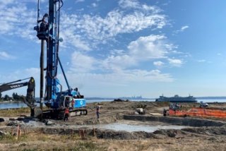
A perimeter wall is being built along seaward portions of the former wood-treating area to protect the site from sea level rise and reduce the effect of erosive forces from Puget Sound. Prior to design of the wall, the USACE performed extensive modeling to assess potential forces at the site. The maximum design earthquake (MDE) for the 100-year design life of the structure is a 950-year seismic event. To assist in design of the wall, the USACE calculated projections of sea level rise under low, intermediate and high rates of global sea level.
The perimeter wall will consist of a reinforced cutter soil mix armored by marine-grade, cast-in-place concrete. The concrete will extend at least 6 feet below beach elevation to protect the wall from corrosive saltwater and other environmental conditions. The completed perimeter wall is anticipated to meet stringent standards regarding site-specific seismic threats.

Based on the results of 2022 pilot-scale implementation, in situ soil solidification/stabilization (ISS) of heavily contaminated soil will be conducted in upland areas. The use of ISS is anticipated to help mitigate soil instability associated with seismic activity. Prior to ISS implementation, a subsurface soil-bentonite slurry “cutoff” wall will be constructed to reroute upgradient groundwater. ISS will be performed through bucket mixing, auger mixing and jet grout techniques. A low permeability cap will be installed over both treated and untreated soil. The upland cap design uses the USACE high-rate scenario (2.78 feet) for sea level rise projected from 2015 to 2070, which is consistent with sea level rise projections used in the perimeter wall design.
After construction of the new cap is complete, a bioswale-retention pond will be built to collect and transmit stormwater away from the cap and toward an outlet at the site's west beach. The outlet will be equipped with a small rock bed for flow dissipation and fitted with a tide gate to prevent backflow during high tides. The pond will be designed to convey stormwater flows resulting from 25-year, 24-hour storm events, with sufficient capacity to retain stormwater from a 100-year storm event without overtopping. Future climate scaling factors of +6% and +3% were added for the 25-year and 100-year storm events, respectfully, to account for an increase in precipitation projected by regional climate models extending to 2070. The pond is anticipated to include a perimeter buffer containing native plants that have naturally adapted to local conditions and can help prevent erosion and filter excess nutrients.

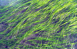
The near-shore areas are periodically inspected to help monitor the performance of the remedies and the rigor of affected aquatic biota. Additionally, EPA is collaborating with the Washington Department of Natural Resources and Suquamish Tribe in surveys and protection of potentially affected native eelgrass (Zostera marina), which provides critical fish and invertebrate habitat in Puget Sound. The species also has important ecological functions such as stabilizing sediment, absorbing carbon and nitrogen, and filtering harmful bacteria. EPA is pursuing a pilot study focused on eelgrass transplanting within the active remedial footprint.
EPA is currently compiling a climate action plan for this site, based on sustainability and resiliency experiences to date. The plan includes specific actions to address seismically induced impacts. As current owners of the site, the City of Bainbridge Island and the Bainbridge Island Metro Park and Recreation District plan to integrate the remediated site into a regional public park that provides improved access to Eagle Harbor.
Superfund Climate Resilience
EPA provides additional information about approaches for building climate resilience at Superfund sites.
Overview of Climate Adaptation Measures
The U.S. EPA is integrating resilience measures into design and maintenance of the site remedies:
- Designing the site perimeter wall to address regional seismic risk.
- Using reinforced concrete to build the perimeter wall, which proves resilience to sea level rise and reduces the effect of erosive forces from Puget Sound.
- Installing an upland soil cap designed to tolerate a high-rate scenario of sea level rise projected for 2015-2070.
- Managing stormwater shed from the upland soil cap through use of a bioswale-retention pond.
- Conducting inspections and surveys in Eagle Harbor to monitor remedy performance and increase understanding of the potential impacts of climate change or other conditions on the aquatic biota.
- Collaborating with the Washington Department of Natural Resources and Suquamish Tribe to assure eelgrass is protected at the site to the maximum extent possible.
- Developing a site-wide climate action plan to assure remedy protectiveness in light of ongoing climate change.
Key Tools Used for Climate Projections
- National Oceanic and Atmospheric Administration, National Integrated Drought Information System, Keetch-Byram Drought Index (KBDI) – U.S. Forest Service [wildfire risk]
- Earth System Grid Federation (ESGF) Peer-to-Peer (P2P) enterprise system [future climate conditions]
- European Centre for Medium-Range Weather Forecasts (ECMWF) [extreme wind]
Points of Contact
- Jacob Moersen, U.S. EPA Region 10
- Bernadette Wright, U.S. EPA Region 10
- Kristen Reed, Washington Department of Ecology
References
- Record of Decision Amendment: Wyckoff/Eagle Harbor Superfund Site Operable Units 1, 2, and 4 Beaches and Perimeter Wall, U.S. EPA Region 10, May 1018
- Fifth Five-Year Review Report: Wyckoff Co./Eagle Harbor Superfund Site, U.S. EPA Region 10, July 2022
- Preparing for Climate Change, City of Bainbridge, Washington
- Eagle Harbor Wyckoff, Washington Department of Ecology
