ICLUS Data for the Southwest Region (V.1)
ICLUS data made available to the Regional groups of the National Climate Assessment consists of population and housing density. Population data are based on the 2000 U.S. Census and use fertility rates from the Census Bureau to project population to 2100 in 5-year time steps for each county in the conterminous United States. By using high and low fertility rates, scenarios are consistent with A2 and B1 scenarios, respectively. The population data are used as inputs to a spatial allocation model, which produces maps of housing density. These data are classified into four categories of urban, suburban, exurban, and rural. The resolution of these data is 1 hectare.
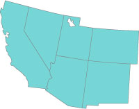
Datasets available here cover the Southwest region. All data are compatible with standard Geographic Information Systems (GIS).
| Dataset to download | Description | Metadata |
|---|---|---|
| Population Data (A2 & B1 files) | 393 K, Shapefile format | County Population Projections |
| A2 Housing Density Data | 92.1 MB, GRID format | Housing Density Projections (Classified) |
| B1 Housing Density Data | 93.1 MB, GRID format | Housing Density Projections (Classified) |
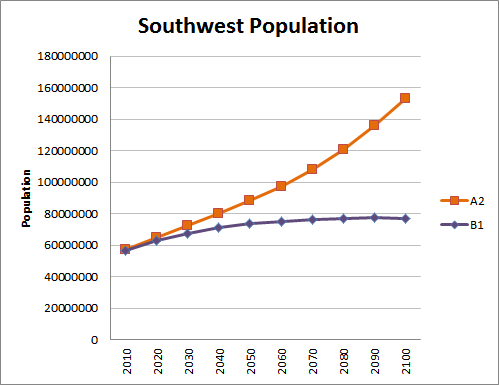
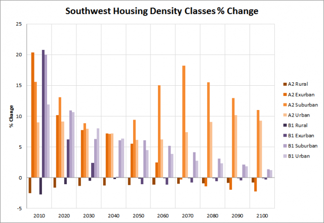
The graphs below provide an overview of population and housing density trends across the two scenarios, A2 and B1, over time for the Southwest region.
Additional Information about ICLUS
Detailed documentation of the ICLUS project is available: the land-use scenarios report includes examples of modeling methods, a GIS tool, and the full datasets for the conterminous United States, as well as additional scenarios.
- Learn more about the Land-Use Scenarios Report at Land-Use Scenarios: National-Scale Housing-Density Scenarios Consistent with Climate Change Storylines (Final Report)
- Learn more about the GIS tool and datasets at ICLUS Tools and Datasets (Version 1.3 & 1.3.1)


