
Healthy Communities Research Milestones
On this page, view by decade:
EPA researchers work to identify and quantify aspects of the natural (ecosystems) and human-dominated (built) environments and how they underpin community health, prosperity, and resiliency.
2020s
2023-Community-Engaged Research Collaborative for Learning and Excellence (CERCLE)

In partnership with EPA's Region 2 (serving New Jersey, New York, Puerto Rico, the U.S. Virgin Islands and eight Indian Nations), EPA established a first-of-its-kind Community-Engaged Research Collaborative for Learning and Excellence (CERCLE) at the Edison Environmental Center in Edison, NJ. In FY23, EPA led an intensive recruitment and on-boarding process for a Title 42 Senior Scientist to lead CERCLE; oversaw early CERCLE stand-up activities to engage local, underserved communities to better understand their needs; developed hiring plans to staff CERCLE; initiated design of CERCLE concepts of operation and processes; and identified priorities for initial community projects. EPA continued engagement with stakeholders, potential community and academic collaborators, and New York/New Jersey Environmental Justice leaders.
2023-Strengthening Environmental Protection through Participatory Science
Participatory science involves the public in advancing scientific knowledge by formulating research questions, collecting data, and interpreting results, helping to fill information gaps, increase public engagement, and improve public understanding of environmental issues. EPA developed the Policy Guidelines and a new Checklist of Requirements to ensure that EPA staff who are designing participatory science projects are informed of and adhere to all relevant policies and other requirements.
Policy Guidelines & Checklist for Participatory Science Projects
2023-Using Challenges and Prizes Program to Create Opportunities for Change in Communities
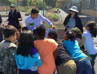
People who are directly affected by local environmental and public health issues are often well positioned to help identify innovative solutions. Recognizing the creative potential in these communities, EPA has used its Challenges and Prizes program to crowdsource creative, community-led solutions that help address critical environmental issues, helping to build capacity and promote community engagement.
EPA’s Community-focused Challenges
2023-New EnviroAtlas Functionality for Landscape Assessments
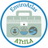
EPA researchers released a key update to the Analytical Tools Interface for Landscape Assessments GIS toolbox in EnviroAtlas which calculates landscape and landscape/human interaction indicators. In addition, the Watershed Resource Registries & EnviroAtlas Featured Collection is now available, which helps environmental professionals and water resource stakeholders explore nationally available data on landcover, water and soil, agriculture, wetland presence, species diversity, and potential project opportunity areas related to Water Resource Registries.
EnviroAtlas EnviroAtlas Analytical Tools Interface for Landscape Assessments Update
Watershed Resource Registries & EnviroAtlas Featured Collection
2022-Agency releases EPA Cumulative Impacts Report
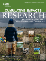
The EPA report Cumulative Impacts Research: Recommendations for EPA’s Office of Research and Development, focuses on recommendations to enhance cumulative impact research that are applicable across each of the EPA Office of Research and Development's (ORD) six National Research Programs. The report represents ORD’s commitment to develop an integrated cumulative impact research portfolio, in collaboration with others, to inform decision-making at all levels.
2022-EPA Launches Strategy to Protect Communities from Lead
Agency researchers played a critical role in helping EPA launch its first-ever, Agency-wide strategy.
Final Strategy to Reduce Lead Exposures and Disparities in U.S. Communities
2022-Researchers Assist Rockford, IL in Neighborhood Revitalization

EPA researchers worked with the City of Rockford, Illinois to conduct a Health Impact Assessment (HIA) to help revitalize the South Main Corridor Area. The HIA recommended strategies to maximize the potential health benefits and mitigate the potential adverse health impacts of neighborhood revitalization.
Southwest Rockford Revitalization Rapid Health Impact Assessment (Final Report)
2021 - Science for the San Juan Bay Estuary
Researchers worked with local partners in San Juan, Puerto Rico, to understand how San Juan Bay Estuary and its residents are impacted by the closure of the Caño Martín Peña – 3.75-mile-long tidal channel that has become almost completely blocked due to infilling of sediment and other debris.
Science and Social Justice in the San Juan Bay Estuary
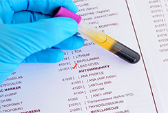
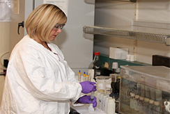
2021 - Lead Exposure through Household Dust and Soil: EPA Researchers Looking for a Solution
Researchers investigated the potential of soil additives, or amendments, in helping to reduce childhood exposure to lead. The amendments bind with lead to prevent any ingested lead from being absorbed into the gastrointestinal system, reducing human lead exposure and potentially saving millions of dollars in cleanup costs at lead-contaminated sites.
Lead Exposure through Household Dust and Soil: EPA Researchers Looking for a Solution
2021 - Keeping the Lead Out
Researchers completed major bodies of work to identify sources of lead and reduce exposure risks, a major public health priority. These include: tools to help EPA and water utilities quantify lead in drinking water and identify sources in home and school plumbing systems; technical support for assessing point-of-use filters for drinking water; and updates for the Integrated Exposure Uptake Bio-kinetic model for estimating blood lead level.
EPA Lead (Pb) Research | US EPA
2021 - Proctor Creek Story Map Helps Inform Decision-making

Using a Health Impact Assessment approach, EPA researchers collaborated with Proctor Creek residents in Atlanta, Georgia, and stakeholders to develop the Proctor Creek Watershed Story Map to identify optimal locations for green infrastructure to manage wet weather impacts on the community. This approach serves as a model for solving environmental and public health challenges that involve communities in decision-making.
Proctor Creek Watershed Story Map: The Intersection of Green Infrastructure and Health
2021 - Health Impact Assessment Supports Water Quality Protection
EPA conducted a Health Impact Assessment (HIA) of proposed sanitary code changes regarding individual sewerage systems (ISS) in Suffolk County, New York. The HIA provides 42 health-focused, evidence-based recommendations to the county intended to improve water quality and protect public health.
HIA Proposed Code Changes Regarding Individual Sewerage Systems (Suffolk County, NY)
2021 - New EnviroAtlas Resources Help Support Healthy Communities
EPA’s EnviroAtlas, a web-based tool that combines maps, analysis tools and interpretive information on ecosystem services, has two new features: 1) the ability to map assets, hazards, and vulnerabilities related to community resilience and 2) addition of data specific to brownfields to aid grant applicants and grantees. The new resources can be used for making decisions on how to support healthy communities, education, and research.
EnviroAtlas | Community Resilience: An Assessment of Assets, Vulnerabilities, and Natural Hazards
2021 - Accuracy in Predicting Child Blood Lead Levels Near Superfund Sites Improved

The newly updated Integrated Exposure Uptake Biokinetic (IEUBK) Model uses up-to-date data on exposure of children to lead in soil, dust, water, air, and food. The model improves accuracy in predicting blood lead levels in children living near a Superfund site with lead contamination.
Lead at Superfund Sites: Software and Users' Manuals
2020 - EPA Models Advance Sustainability

EPA researchers created a family of models called the U.S. Environmentally-Extended Input-Output Models, or USEEIO, to support sustainable economic growth. In 2020, they advanced the use and application of those models through a partnership with the Georgia Department of Economic Development to work with local communities and volunteer software developers to assess and identify local opportunities for economic growth and environmental sustainability.
U.S. Environmentally-Extended Input-Output (USEEIO) Models
Innovative Web Applications for Local Communities
2020 - Development of Innovative Techniques Helps Get the Lead Out

Reducing risks from lead exposure—particularly to children—is a major public health priority for EPA. In 2020, EPA researchers developed innovative techniques, combining geospatial analysis and public health data (blood lead levels), to identify high exposure locations and the drivers to help target actions in high-exposure communities.
2020 - EPA and Federal Partners Study Ways to Reduce the Risk of Exposure to COVID
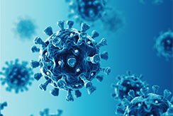
EPA researchers and partners at Centers for Disease Control and Prevention are building on an expansive body of world-class research and applying that knowledge to reduce the risk of exposure to SARS--CoV-2, the virus that causes COVID-19.
2010s
2018 - EPA and Federal Partners Develop the Lead Action Plan
EPA and partners with Housing and Urban Development and Health and Human Services to develop the Federal Lead Action Plan. The Plan a blueprint for reducing lead exposure. Under this plan, EPA researchers are working to understand the drivers of blood lead levels and inform regulatory decisions.
Federal Action Plan to Reduce Childhood Lead Exposure
2017 - EPA's “Virtual Stomach” Method Guides Soil Cleanup
EPA validates a method to guide cleanup of soils contaminated with lead and arsenic. The "virtual stomach" method mimics how the human body absorbs the contaminants and saves millions of dollars in cleanup costs.
New Testing Method for Lead and Arsenic in Contaminated Soil Saves Money and Protects Public Health
2012 - EPA Releases the Eco-Health Relationship Browser
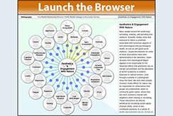
EPA releases the Eco-Health Relationship Browser to help communities and others better account for and protect the benefits they derive from natural ecosystems. The browser is designed to increase understanding of the nation’s ecosystems, the services they provide, and how those services benefit public health and well-being.
EnviroAtlas Eco-Health Relationship Browser
2000s
2003 - EPA Begins Work on the Report on the Environment

EPA began a bold initiative to assemble, for the first time, the most reliable available indicators of national environmental and health conditions and trends that are important to EPA’s mission. The Agency released the Report on the Environment and a companion report in 2008. EPA continues to update the report that provides the best available indicators of national trends in the status and condition of the U.S. environment and human exposure and health.
EPA's Report on the Environment (ROE)
1990s
1997 - EPA Helps Establish NIEHS/EPA Children's Centers

EPA and National Institute of Environmental Health Sciences (NIEHS) establish Children's Environmental Health and Disease Prevention Research Centers (Children's Centers). The Children's Centers have produced knowledge vital to demonstrating and halting the health effects of low-level lead exposure to children.
NIEHS/EPA Children's Environmental Health and Disease Prevention Research Centers