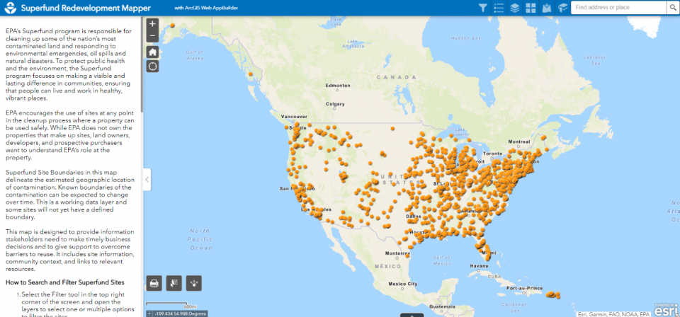
Superfund Redevelopment Mapper
To help communities affected by Superfund sites reclaim and return land to safe and beneficial use, EPA has developed the Superfund Redevelopment Mapper. This web-based mapping tool helps stakeholders explore potential reuse opportunities. It provides users with Superfund site locations and options for adding data layers that highlight site features and site surroundings. Any existing GIS data layer can be added to the tool, allowing users to explore more information about their communities, such as income levels, unemployment numbers and land features. Examples of the tool’s uses include:
- A shopping mall developer interested in properties near freeways, shipping services or affordable housing for workers.
- A solar farm developer focused on rural locations with solar potential and access to high-voltage power lines.
- Local governments that want to identify communities with a lack of basic services, such as nearby grocery stores and health care centers, or green space and recreation facilities.
- Community redevelopment authorities and other organizations seeking to bring businesses to areas of high unemployment.
EPA strives to provide key information to help stakeholders make informed business decisions about land reuse that align with community needs and priorities. This tool has been developed to help ensure that Superfund site cleanups pave the way for communities to return properties to beneficial use.
Watch a short video on how to use the tool
View the Superfund Redevelopment Mapper User Guide (pdf) (1.1 MB)
Explore the Superfund Redevelopment Mapper Tool

If you have questions about the Superfund Redevelopment Mapper or would like to share feedback, please contact [email protected].
