Superfund Sites in Reuse in Maine
If you are having trouble viewing the map in your browser, click the 'View larger map' link below
BANGOR GAS WORKS

From 1852 to 1963, the 6-acre Bangor Gas Works site operated as a coal gasification plant in Bangor, Maine. The extracted gas provided the city of Bangor with electricity. Operations stored the remaining thick tar waste in large tanks on site. Tar deposits contaminated site soils and sediments of the nearby Penobscot River. After residents reported fumes from sewer lines and tar sheen on the river surface, the city of Bangor acquired the site in 1978. The city removed site structures and extracted and removed some contaminated materials from the site. The city also buried and capped some contaminated materials on site. Redevelopment activities paved over the capped area for a parking lot. Today, site uses include commercial space with a 60,000-square foot Shaw’s Supermarket as well as recreational space that connects to the Second Street Community Park next to the site.
Last updated September 2024
As of December 2024, the EPA had data on 4 on-site businesses. These businesses employed 153 people and generated an estimated $31,296,000 in annual sales revenue. For additional information click here.
For more information:
BRUNSWICK NAVAL AIR STATION
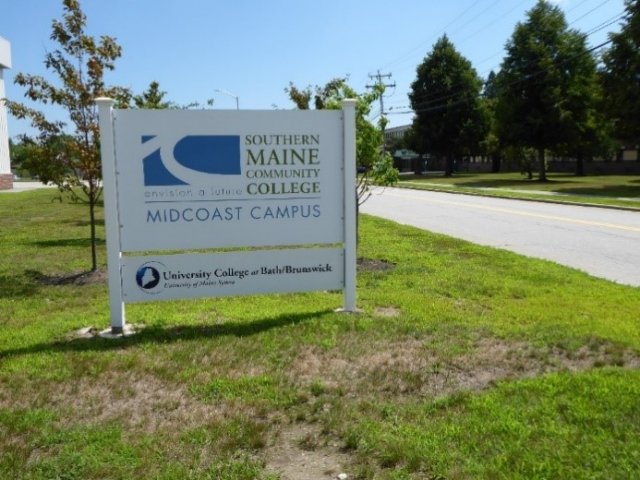
The 3,100-acre Brunswick Naval Air Station Superfund site is located in Brunswick, Maine. The U.S. Navy established Brunswick Naval Air Station during World War II at a former civilian airport on-site. Wastes generated by the U.S. Navy as part of installation activities contaminated soil and groundwater. The EPA placed the Brunswick Naval Air Station on the Superfund program’s National Priorities List (NPL) in 1987. Naval air station operations continued at the site until May 2011, when the air station was officially decommissioned. The U.S. Navy continues to conduct site investigations and cleanup activities. Today, the site supports a wide range of commercial, industrial, recreational, educational, ecological, military, public service, agricultural and residential uses as well as renewable energy projects. The site is home to Brunswick Landing, a mixed commercial and industrial development, as well as the Kate Furbish Preserve and Mere Creek Golf Club. Converted former naval air station housing, new housing units, colleges, schools and vocational training centers, and a general aviation airport are on-site. Housing has also expanded, with over 4,000 residents estimated to be living at the former base.
Last updated September 2024
As of December 2023, the EPA had data on 122 on-site businesses. These businesses employed 1,754 people and generated an estimated $272,095,456 in annual sales revenue. For additional information click here.
For more information:
- Reuse and the Benefit to Community A Beneficial Effects Economic Case Study for the Brunswick Naval Air Station Superfund Site (PDF)
- Superfund Site Profile Page
CALLAHAN MINING CORP
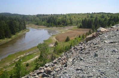
The over 150-acre Callahan Mine Superfund site is in Brooksville, Maine. Metal mining operations began at the site in 1868 and ended in 1972. In 1975, the Maine Department of Marine Resources studied marine organisms in the adjacent Goose Pond and found elevated levels of metals. The Maine Department of Environmental Protection did more sampling in 1999. The studies found hazardous substances in site soils and nearby residential properties, site groundwater and on-site waste materials. The EPA added the site to the National Priorities List (NPL) in 2002. The EPA finalized the cleanup plan for part of the area in 2011. From 2010 to 2013, the EPA led soil cleanup of residential properties and removed contamination from the former Mine Operations Area. Institutional controls to restrict land use and prevent groundwater use are in place. Design work to stabilize the tailings dam and cover the tailings impoundment finished in 2015. Design work for the excavation of contaminated sediments, wetlands restoration, institutional controls and monitoring finished in 2019. In 2020, the EPA put in a stone buttress against the tailings dam and graded the tailings impoundment to allow installation of a geosynthetic cover system in 2021. In 2022, the EPA began the excavation and relocation of Waste Rock Pile #3 and completed that work in 2023. In 2023, the EPA completed the excavation of the contaminated areas in the salt marsh and began excavation of the contaminated sediments in Goose Pond. The contaminated sediments and Waste Rock Pile #3 material will be capped at the Stink Cove Repository in 2025 or 2026. In 2023, the EPA began dredging the contaminated sediments in Goose Pond. The sediment dredging should be complete in 2024. The EPA also began the excavation of contaminated hot spot areas and the placement of an in-situ soil cover in Dyer Cove. The work remaining after 2024 includes the dredging of Goose Cove. The site is one of over 100 Superfund sites receiving an infusion of resources from the 2021 Bipartisan Infrastructure Law to initiate and restart cleanups. The funding will expedite the cleanup and help protect the surrounding Brooksville community. In 2009, the EPA did a reuse assessment for the former Callahan Mine property and Goose Pond. It was based on the goals of the site owner, local regulations, community input and reasonably anticipated future land uses. It recommended a habitat conservation area with potential recreation opportunities for the site. The Site is privately owned and is subject to limited recreational use in Goose Pond.
Last updated September 2024
As of December 2024, the EPA did not have economic data related to on-site businesses, or economic data were not applicable due to site use. For additional information click here.
For more information:
EASTERN SURPLUS
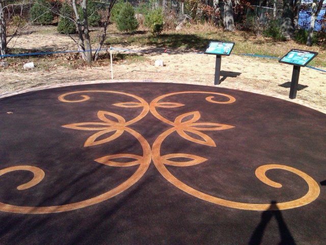
The 5-acre Eastern Surplus Company Superfund site is located along Meddybemps Lake and the Dennys River in Meddybemps, Maine. The Eastern Surplus Company, an army surplus and salvage retailer, was on-site from 1946 until the early 1980s. Facility operations contaminated soil and groundwater with hazardous substances. A facility inspection in 1984 found evidence of a release and the Maine Department of Environmental Protection (MEDEP) started emergency cleanup in 1985. The EPA took responsibility for the cleanup in 1986. The EPA added the site to the National Priorities List (NPL) in 1996. To clean up the site, the EPA removed contaminated soil and materials and disposed of them off-site and began running a groundwater treatment system in 2000. The EPA later updated the remedy, suspending groundwater extraction and treatment and using enhanced in-place bioremediation instead, based on the success of a pilot study and post-treatment monitoring. The groundwater treatment system remains offline while the EPA and MEDEP evaluate the effects of the remedy improvements. In the early 2000s, site investigations found Native American artifacts. The northern part of the site, named N’tolonapemk (Our Ancestor’s Place) by the Passamaquoddy Tribe, is identified as a significant archaeological site. It is listed on the National Register of Historic Places. In 2012, the EPA constructed a commemorative plaza and pathway for the area. Downeast Salmon Federation coordinated with the tribe and state to restore a historic spawning run area for alewives on the Dennys River located on-site. In 2023, dam removal and construction of weirs were completed to assist the culturally significant tribal resource reach spawning habitat in Meddybemps Lake. Land uses near the site remain mostly residential and agricultural. The EPA anticipates continued recreational use on the northern part of the site as well as residential and agricultural use on the southern part of the site.
Last updated September 2024
As of December 2024, the EPA did not have economic data related to on-site businesses, or economic data were not applicable due to site use. For additional information click here.
For more information:
EASTLAND WOOLEN MILL
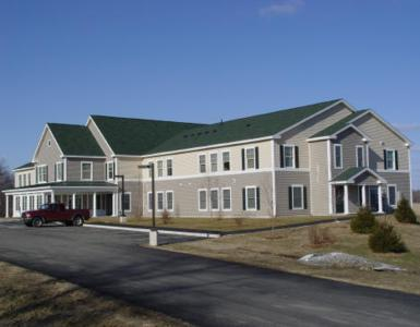
The 25-acre Eastland Woolen Mill Superfund site is located on Main Street in downtown Corinna, Maine. A textile mill was active on-site from 1909 to 1996. Disposal practices resulted in contamination of sediments in the East Branch of the Sebasticook River as well as soil and groundwater. The EPA added the site to the National Priorities List (NPL) in 1999. Cleanup activities included removal of hazardous materials, the mill and contaminated soils. Cleanup activities also included installation of a water line and treatment of contaminated soils and groundwater. EPA’s close coordination with the community helped ensure the beneficial reuse of the well-located property. In 2001, EPA’s Superfund Redevelopment Program provided a grant to the town of Corinna for a community-based reuse assessment and reuse plan. Based on these plans, a 20-unit senior housing facility opened on part of the site in 2006. EPA, the town of Corinna and the state of Maine also relocated the historic Odd Fellows Building from the site to a new location across Route 7. The site is also home to the town of Corinna War Memorial and a community bandstand. A community boardwalk runs through green space along the river. Ecological uses on-site include the river and wetlands. The remainder of the site includes commercial, residential and mixed-use areas. In 2012, the EPA took 80% of the site’s land area off the NPL after determining that cleanup of the area was complete. This area includes several properties that are available for reuse. Site stakeholders hope the area’s deletion from the NPL will further clarify the site’s cleanup status and help support further reuse. In 2023, the town started construction of a new firehouse on parts of the deleted area.
Last updated September 2024
As of December 2024, the EPA had data on one on-site business. This business employed 3 people and generated an estimated $75,130 in annual sales revenue. For additional information click here.
For more information:
- Reuse and the Benefit to Community: A Beneficial Effects Economic Case Study for the Eastland Woolen Mill Superfund Site (PDF)
- Site Redevelopment Profile: Eastland Woolen Mill Superfund Site (PDF)
- Superfund Site Profile Page
LORING AIR FORCE BASE
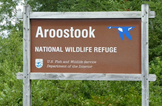
The Loring Air Force Base Superfund site is in Limestone, Maine. The roughly 9,000-acre Base was a major Strategic Air Command (SAC) base for the U.S. Air Force for over 40 years, before its closing in 1994. The Base housed a bomber wing and had SAC’s largest capacity for weapons and fuel storage. Military operations contaminated soil, groundwater, surface water and sediment. The EPA added the site to the National Priorities List (NPL) in 1990. Cleanup included waste removal, excavations, landfill capping, institutional controls to prevent uncontrolled use and consumption of groundwater, provisional water supplies, long-term monitoring, and groundwater management zones. Some cleanup activities and investigations are ongoing. The U.S. Air Force transferred the site to the Loring Development Authority. They worked with the U.S. Air Force and the EPA to establish the Loring Commerce Centre, an industrial complex, aviation center and business park on-site. Businesses and federal agencies in the commerce center provide employment and income for the surrounding community. Tax credit and exemption programs, such as the Job and Investment Tax Credit and the Research Expense Credit, offer additional incentives to potential new tenants. Redevelopment at the site serves as a success story for other Base Realignment and Closure (BRAC) facilities. U.S. Fish and Wildlife Service maintains the Aroostook National Wildlife Refuge on-site, which provides space for recreation while protecting a diverse array of native wildlife habitats and species. The Loring Military Heritage Center is also on-site, preserving the history and legacy of Loring Air Force Base through education and museum exhibits.
Last updated September 2024
As of December 2023, the EPA had data on 30 on-site businesses. These businesses employed 799 people and generated an estimated $6,974,770 in annual sales revenue. For additional information click here.
For more information:
- Reuse and the Benefit to Community A Beneficial Effects Economic Case Study for Loring Air Force Base Superfund Site (PDF)
- Superfund Site Profile Page
PINETTE'S SALVAGE YARD
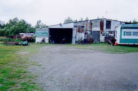
The 12-acre Pinette’s Salvage Yard Superfund site is about a mile southwest of Washburn, Maine. In 1979, three electrical transformers broke at the site. Fluids containing hazardous chemicals spilled directly onto the ground. The fluids moved through the soil, contaminating groundwater and surface water. In 1982, the EPA added the site to the National Priorities List (NPL). In 1983, the EPA removed some contaminated soil and disposed of it off-site. EPA’s cleanup plan addressed contaminated groundwater and remaining contaminated soil. After cleanup, the EPA took the site off the NPL in 2002. EPA’s cleanup plan allowed a vehicle repair and salvage yard to continue operating on-site. Today, the vehicle repair and salvage yard business remains active. It stores and dismantles damaged vehicles and sells recovered auto parts. There is also residential use on-site.
Last updated September 2024
As of December 2024, the EPA had data on one on-site business. The EPA did not have further economic details related to this business. For additional information click here.
For more information:
PORTSMOUTH NAVAL SHIPYARD
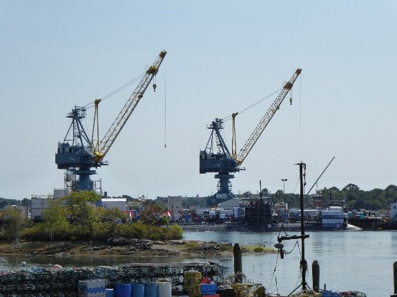
The 278-acre Portsmouth Naval Shipyard (PNS) is a former Superfund site which achieved final deletion in February 2024 and is located in Kittery in York County, Maine. It consists of four islands connected by filled tidal flats. The U.S. Navy uses the Portsmouth Naval Shipyard for naval operations, including construction of ships and submarines. Industrial wastes, including used batteries, asbestos insulation, waste paint, chemical solvents and lead sludge, contaminated soils, groundwater and surface water at the site. This created a potential health risk for the 10,000 people living on and around the site. Contamination also threatened the unique wetlands and rivers nearby. In 1994, the EPA added the site to the National Priorities List (NPL). After the immediate removal of heavily contaminated storage tanks and containment of those areas with a soil cap, the EPA and the U.S. Navy removed localized areas of contaminated soil. They also put in stormwater controls along riverbanks and restored saltwater wetlands. Many decision documents were finalized from 2001 to 2022. A Final Close-Out Report was issued in July 2023. The site remains an active U.S. Navy shipyard with long-term and compliance monitoring and maintenance of land use controls.
Last updated September 2024
As of December 2023, the EPA did not have economic data related to on-site businesses, or economic data were not applicable due to site use. For additional information click here.
For more information:
SACO MUNICIPAL LANDFILL
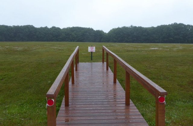
The 90-acre Saco Municipal Landfill Superfund site is in Saco, Maine. The city of Saco owned and operated the landfill from 1963 to 1989. The site includes four disposal areas. Chemicals and wastes contaminated soil and groundwater at the site. In 1990, the EPA added the site to the National Priorities List (NPL). With the EPA and Maine Department of Environmental Protection oversight, the city of Saco cleaned up the site. Cleanup activities included removing waste and removing and placing contaminated sediment under a cap. Cleanup also includes monitoring of natural processes to clean up groundwater and restricting land use. In 1998, the city of Saco began planning for site reuse. The EPA approved a plan to improve wildlife habitat in the former gravel and sand pit in one of the site’s disposal areas. In 2001, the city graded the area, established a vegetative cover, and installed a series of wetland areas next to one of the disposal areas. In 2003, the city completed plans for a community recreation area for hiking, biking, ice skating and soccer. The Saco Parks and Recreation Athletic Complex now includes five soccer fields and a soccer practice area. Sandy Brook runs across the site. Reuse planning is ongoing for unused parts of the site for more city facilities.
Last updated September 2024
As of December 2024, the EPA did not have economic data related to on-site businesses, or economic data were not applicable due to site use. For additional information click here.
For more information:
SACO TANNERY WASTE PITS
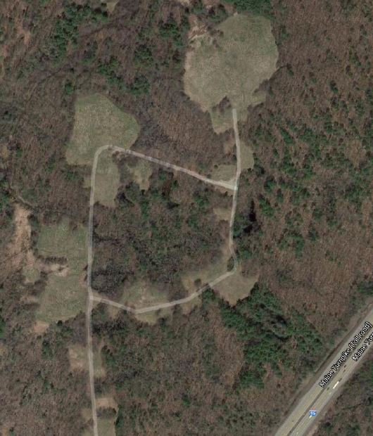
The 212-acre Saco Tannery Waste Pits Superfund site is in Saco, Maine. Saco Tannery Corporation was active on-site from 1959 until 1981. It used on-site waste pits for disposal of process wastes such as chromium sludges, acid wastes, methylene chloride and caustic substances. Disposal activities contaminated soil, groundwater and sediment. The EPA added the site to the National Priorities List (NPL) in 1983. The EPA led a removal action that removed liquid wastes, neutralized sludges, capped pits and installed a fence. Long-term cleanup added soil cover systems for the 53 waste pits, two lagoons, and two areas outside the waste pits, revegetated the site, created compensatory wetlands, and constructed permanent security fencing. After cleanup, the EPA took the site off the NPL in 1999. As part of the cleanup, the creation of compensatory wetlands was required for the wetlands permanently lost with the construction of the soil covers. Site investigations found not enough suitable acreage on-site to offset the acreage lost through the cleanup. In 1993, the Maine Department of Environmental Protection purchased 247 acres of nearby unique and threatened habitat. The property was placed under the management of The Nature Conservancy and is protected from future development. The purchase preserves over 160 acres of highly valued peatland, a unique habitat where northern and southern range species overlap.
Last updated September 2024
As of December 2024, the EPA did not have economic data related to on-site businesses, or economic data were not applicable due to site use. For additional information click here.
For more information:
