Superfund Sites in Reuse in Vermont
If you are having trouble viewing the map in your browser, click the 'View larger map' link below
BENNINGTON MUNICIPAL SANITARY LANDFILL
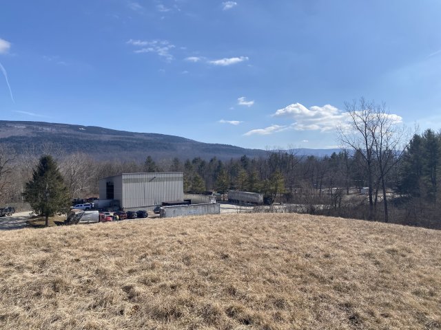
The 15-acre Bennington Landfill Superfund site is a former municipal sanitary landfill in Bennington, Vermont. The landfill received residential, industrial and commercial waste from 1969 to 1987. Several local industries dumped liquid wastes in an unlined lagoon on-site. In 1986, the Vermont Department of Environmental Conservation found contamination in groundwater. The town of Bennington closed the landfill in 1990. The EPA added the site to the National Priorities List (NPL) in March 1989. A non-time-critical cleanup action included digging up contaminated soil and sediment and consolidating them in the landfill, capping the landfill, diverting surface water and groundwater, collecting landfill liquids, and managing landfill gases. After these activities, an investigation confirmed that no further action was necessary. Monitoring and long-term operation and maintenance activities are ongoing. Institutional controls limit access to and use of the site and prevent disturbance of the remedy. A waste and recycling service station is active on the non-landfill part of the site.
Last updated September 2024
As of December 2024, the EPA had data on one on-site business. This business employed 2 people and generated an estimated $499,000 in annual sales revenue. For additional information click here.
For more information:
BURGESS BROTHERS LANDFILL
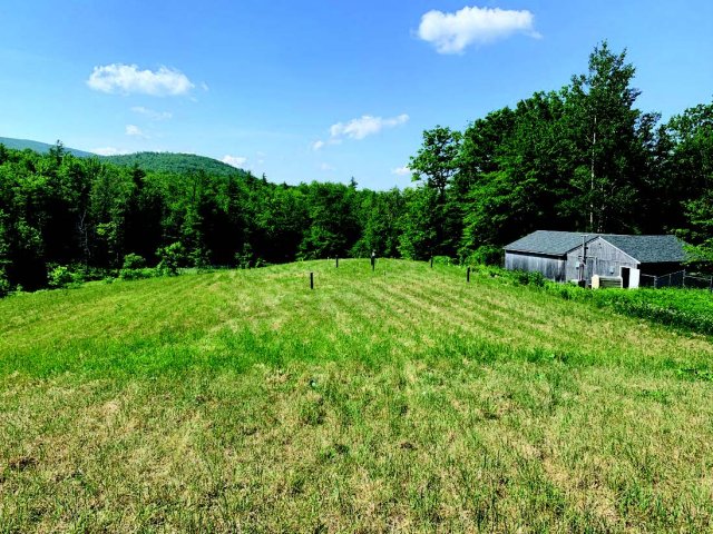
The Burgess Brothers Landfill Superfund site is in Bennington, Vermont. Burgess Brothers Construction Company ran a sand pit, salvage yard and landfill on-site from the 1940s to the mid-1970s. Two lagoons received liquid wastes and sludge from about 1967 to 1976. Union Carbide Corp.’s Bennington Plant disposed of wastes from battery manufacturing, an unknown quantity of lead sludge and the equivalent of 47,780 drums of hazardous wastes at the site. Facility operations contaminated soil, groundwater and surface water with heavy metals and volatile organic compounds. The EPA added the site to the National Priorities List (NPL) in 1989. The site’s potentially responsible parties (PRPs) led cleanup efforts, with the EPA's oversight. Cleanup included removal of contaminated soil, capping of the landfill area, and groundwater treatment and monitoring. Institutional controls prevent exposure to contamination and a fence surrounds the landfill area. The site lies within the Green Mountain National Forest.
Last updated September 2024
As of December 2024, the EPA did not have economic data related to on-site businesses, or economic data were not applicable due to site use. For additional information click here.
For more information:
COMMERCE STREET PLUME
The Commerce Street Plume Superfund site is in Williston, Vermont. It includes a former wastewater lagoon and a 70+ acre groundwater plume that extends beneath a commercial and residential area. Between 1979 and 1984, an electroplating business discharged rinse waters and sludge wastes containing heavy metals and industrial solvents into the unlined lagoon. After an employee report to the Vermont Agency of Environmental Conservation in 1982, the state found the company in violation of hazardous waste regulations for the disposal of chromium-contaminated wastes. The EPA added the site to the National Priorities List (NPL) in 2005. Cleanup included digging up and disposing of contaminated soil, replacing it with clean material, and planting and re-seeding the excavated area. It also includes groundwater treatment and monitoring and addressing groundwater vapors in buildings as needed. The EPA has taken steps to mitigate vapors in one home. Institutional controls restrict access to contaminated soil and groundwater. In December 2021, the site was among those selected by the EPA to receive cleanup funding under the Bipartisan Infrastructure Law (BIL). With this funding, the EPA is initiating work on backlogged remedial construction projects and accelerating cleanups at NPL sites, including implementation of the groundwater remedial action at this site. Current site uses include a mix of light-industrial/commercial businesses and single-family residences.
Last updated September 2024
As of December 2024, the EPA had data on one on-site business. The EPA did not have further economic details related to this business. For additional information click here.
For more information:
ELIZABETH MINE
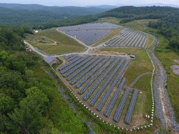
The Elizabeth Mine Superfund site is in Strafford and Thatford, Vermont. The site contains waste rock, roast beds and mine tailings left behind after 150 years of mining activity. Mining wastes contaminated groundwater, soil and sediment with heavy metals and acid-rock drainage. Mining wastes also contaminated the adjacent West Branch of the Ompompanoosuc River, Lord Brook and two tributaries. The EPA added the site to the National Priorities List (NPL) in 2001. In 2005, the EPA stabilized the tailing pile with soil and repaired the tailing dam, preventing the release of large quantities of mining waste and potential catastrophic loss of life and property downstream. The EPA built an active water treatment system in 2008 that operated until 2018. The active water treatment was replaced with a passive treatment system in 2019. The EPA consolidated and covered the mining waste in 2012 with reuse in mind. During cleanup, the EPA restored 15 acres of wetland for ecological reuse. In 2014, the U.S. Army Corps of Engineers Sustainability Award Program presented the Green Dream Team Award to the Elizabeth Mine Superfund Site Project Delivery Team for wetland restorations at the site. As a result of the cleanup, the state of Vermont delisted the 4 miles of the impaired West Branch of the Ompompanoosuc River and portions of Lord Brook from the Clean Water Act’s impaired waters list based on the recovery of the benthic and fish communities. In 2017, a developer installed a 7-megawatt solar array on the radiated tailings pile. Today, the project supplies electricity to the Green Mountain Power grid and produces enough energy to power about 1,200 homes. The EPA completed the cleanup of the South Mine and South Open Cut areas in 2020. The EPA completed construction of all remedial actions in 2021. The EPA also worked with the Elizabeth Mine Historic Preservation Trust, the Stafford Historical Society, the Vermont Department of Environmental Conservation and the Vermont Division of Historic Preservation to develop and install interpretive panels at the site.
Last updated September 2024
As of December 2024, the EPA had data on one on-site business. The EPA did not have further economic details related to this business. For additional information click here.
For more information:
ELY COPPER MINE
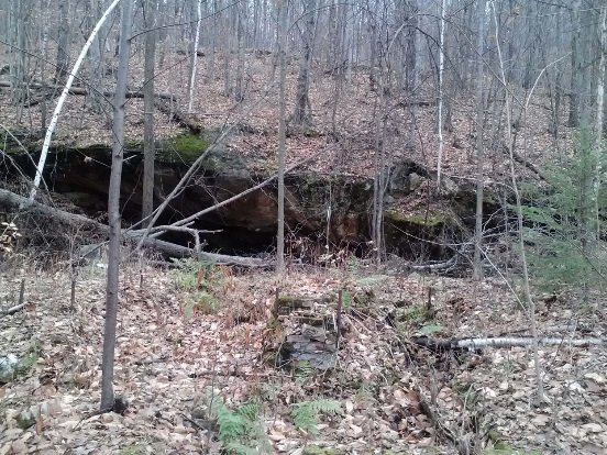
The 350-acre Ely Copper Mine Superfund site is in Vershire, Vermont. From 1821 until 1920, copper mining operations generated piles of waste rock, smelter waste and tailings. Operators disposed of the materials on-site. Activities to remove dump-ore took place between 1949 and 1950. The EPA added the site to the National Priorities List (NPL) in 2001. The EPA finalized cleanup plans for the site in 2011 and 2016. Institutional controls in place prevent groundwater use and restrict site activities to protect the cleanup actions. The design for the cleanup actions finished in 2020. In December 2021, the site was among those selected by the EPA to receive cleanup funding under the Bipartisan Infrastructure Law (BIL). With this funding, the EPA is already initiating work on backlogged remedial construction projects and accelerating cleanups at NPL sites. BIL funding will enable cleanup activities at the site to begin. Cleanup will include excavation and on-site consolidation of mine waste and contaminated sediment as well as closure of adits, or mine openings. Since 1950, activities at the site have included commercial timber management as well as hunting, snowmobile riding and horseback riding. The site also provides habitat for several species of state and federal threatened and endangered bats. An archaeological dig to document historic mining-related artifacts and resources that will be impacted by the cleanup began in 2023 and was completed in June 2024. The US Army Corps was retained by the EPA to procure and manage a contract for the cleanup work. The US Army Corps awarded a contract for the cleanup work in June 2024. This work will involve the excavation of the mine waste and consolidation of the waste into an on-site 6-acre waste cell. This work is expected to begin in fall 2024 and continue through 2026.
Last updated September 2024
As of December 2024, the EPA did not have economic data related to on-site businesses, or economic data were not applicable due to site use. For additional information click here.
For more information:
PINE STREET CANAL
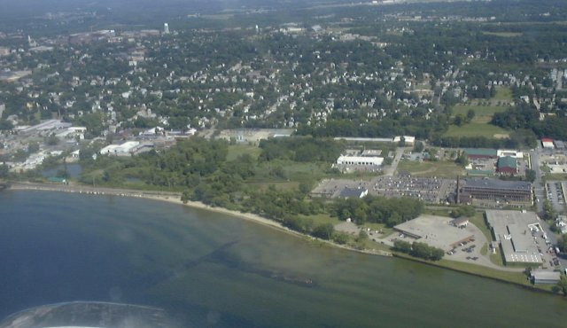
The 38-acre Pine Street Canal Superfund site is in Burlington, Vermont. It consists of a canal and turning basin, wetlands, an area formerly known as Maltex Pond and other land. From 1908 to 1966, a coal gasification plant was on-site. Plant operators disposed of wastewaters, residual oil and wood chips saturated with organic compounds in the canal wetland. These actions contaminated soils, surface water, sediments, groundwater, air and wetlands. While investigating the site for a proposed major highway development, the state of Vermont found high levels of organic compounds associated with coal tar. The EPA added the site to the National Priorities List (NPL) in 1983. Cleanup has taken place in phases. Cleanup activities include removing coal tars, capping underwater sediments in the canal and Maltex Pond sediments, restoring habitat, putting in vertical barrier walls and monitoring groundwater. Cleanup efforts also established institutional controls that restricts residential use, daycare facilities and activities that could affect the remedy. Habitat restoration allowed wetlands to continue functioning. Wetland restoration took place from 2003 to 2004. The wetlands support mammals, birds, reptiles, amphibians and fish. The Burlington Electrical Department headquarters has been on-site since before the site’s NPL listing. Cleanup also spurred commercial development east of Maltex Pond, outside the site’s eastern boundary. While not on-site, businesses and construction in the Maltex Partnership development area comply with site-related land use restrictions. Sunken barges in the canal and other features at the site are eligible for the National Register of Historic Places. EPA, the Vermont State Historic Preservation Officer and the Performing Defendants agreed to a mitigation plan for these historic resources when the remedy was put in place. The site is in a federal Opportunity Zone, which are census tracts of low-income and distressed communities designated by state governors and certified by the U.S. Department of the Treasury. In 2022, $6 million was provided for brownfield cleanup and redevelopment at a parcel next to the site. The proposed redevelopment projects include a bathhouse and wellness space and a multi-tenant commercial retail building. Developers and the city are also exploring the possible creation of a green gateway and utilize city-owned parcels on-site as public open space.
Last updated September 2024
As of December 2024, the EPA had data on one on-site business. This business employed 10 people and generated an estimated $3,187,770 in annual sales revenue. For additional information click here.
For more information:
POWNAL TANNERY
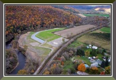
The 28-acre Pownal Tannery Superfund site is in North Pownal, Vermont. In the late 1880s, a woolen mill began operations in the area, followed by a hide tanning and finishing facility that began operating there in 1935. After the facility’s closure in 1988, the EPA found contamination in groundwater, soil and sludge and led removal actions before and after adding the site to the National Priorities List (NPL) in 1999. These actions included removing contaminated materials and the tannery mill building, decontaminating a facility warehouse, and capping a facility landfill. The EPA completed these activities in 2001. Further investigations resulted in a 2002 cleanup decision that included treating soil and sludge within a former onsite lagoon area and consolidating it under a protective cap. The final remedy also required land use restrictions and long-term monitoring of groundwater and river sediments. The EPA worked with the town of Pownal to coordinate reuse planning as part of the cleanup process. Funded by a 1999 Superfund Redevelopment Program pilot grant, the town developed plans for recreation areas and a new wastewater treatment plant onsite. The treatment plant, completed in 2006, occupies part of the former lagoon area. The town reused old forest beams from the former tannery building to build a recycling center and equipment shed. Multi-use facilities on-site include a small park and benches, a historical marker near the North Pownal Bridge, and the Hoosic Trail walking path and boardwalk in the former lagoon area.
Last updated September 2024
As of December 2024, the EPA had data on one on-site business. The EPA did not have further economic details related to this business. For additional information click here.
For more information:
TANSITOR ELECTRONICS, INC.
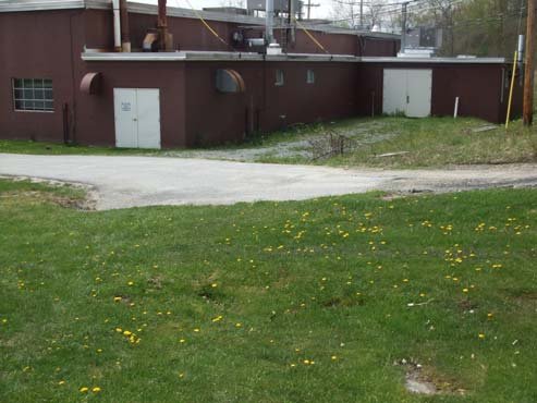
The 44-acre Tansitor Electronics, Inc. Superfund site is in Bennington, Vermont. About 36 acres of the site are north of Route 9; the remainder of the site is south of Route 9. Since 1956, various owners have made electrical components on part of the site. In 1981, Vishay-Tansitor notified the EPA that operations between 1956 and 1979 had disposed of organic solvents and acids at the site. Disposal practices contaminated soil, sediment, groundwater and surface water. The EPA added the site to the National Priorities List (NPL) in 1989. The cleanup plan included a waiver of groundwater standards for a 10-acre area. It also included steps to address monitoring results and place restrictions on groundwater use. Outside the 10-acre area, groundwater contaminant levels are all below cleanup goals. The EPA took the site off the NPL in 1999. Groundwater monitoring is ongoing. Vishay-Tansitor continues to run its manufacturing facility on-site. Forested wetlands cover most of the site south of Route 9.
Last updated September 2024
As of December 2024, the EPA had data on one on-site business. This business employed 138 people and generated an estimated $40,840,000 in annual sales revenue. For additional information click here.
For more information:
